Y Linh Ho, Lao Chai, Ta Van: The Classic Route Explained Step by Step
The classic Sapa valley walk runs about 12 km from Sapa town through Y Linh Ho and Lao Chai to Ta Van, mostly downhill, in 6 to 7 hours with stops. Here is each step, what the trail is like, and how to plan the day.
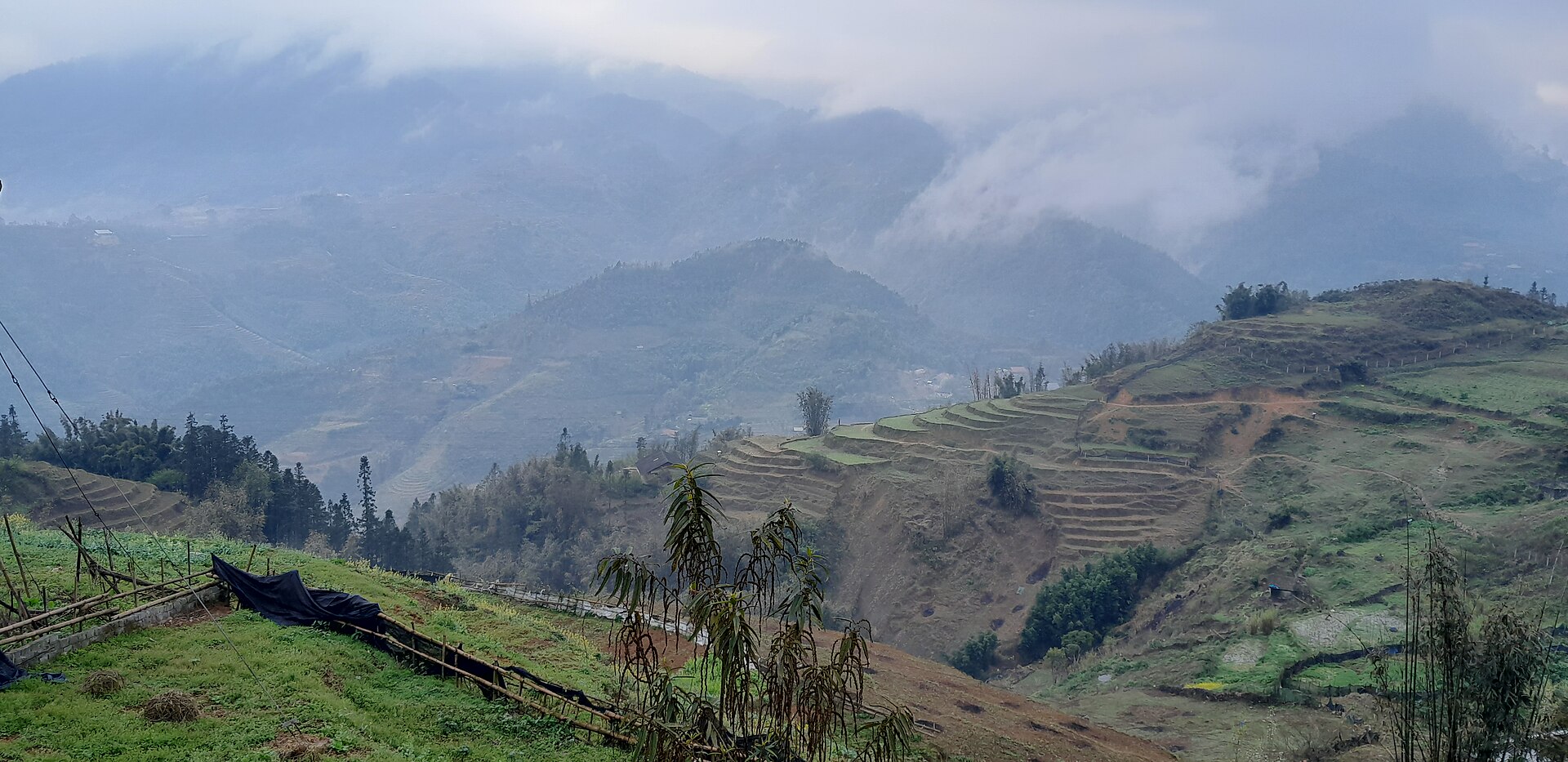
Cover photo: JakobHosp via Wikimedia Commons, CC BY 4.0.

Y Linh Ho, Lao Chai, Ta Van: The Classic Route Explained Step by Step
The classic Sapa trek is one valley walk, not three separate trips. It starts in Sapa town, drops down to the Muong Hoa valley, passes through the villages of Y Linh Ho and Lao Chai, and ends in Ta Van. The whole route is about 12 km, mostly downhill and flat, and it takes 6 to 7 hours at a normal walking pace with stops for photos, lunch, and rest.
That is why this route suits first time trekkers in Sapa. You get terraced valleys, village life, and a full day outdoors, without a summit climb or a long uphill grind. This guide walks the route in order, so you know what comes next at every stage and what to plan before you start.
The route at a glance
Start in Sapa town in the morning, after breakfast. Walk down to Y Linh Ho, continue along the valley to Lao Chai, then follow the valley floor to Ta Van. Most walkers finish in Ta Van in the mid to late afternoon, and either stay the night there or travel back to Sapa town by road.
The path is a mix of stone steps, earth paths, narrow concrete lanes between houses, and flat tracks beside the fields. It is not a paved promenade, and after rain the earth sections turn muddy and slippery. Good walking shoes with grip matter more on this route than fitness does, because the distance is modest and the downhill sections are what tire the knees.
A local guide is the normal way to walk this route, and knows which field path is open that week and where the trail is slippery after rain.
Step 1: Sapa town down to Y Linh Ho
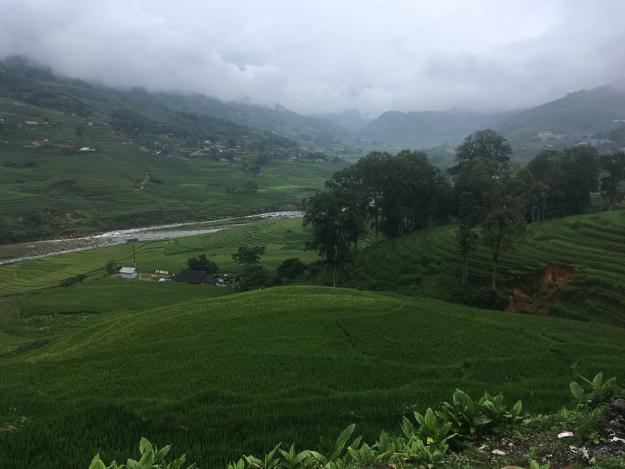
Source: Christophe95 via Wikimedia Commons, CC BY-SA 4.0.

The first section is the steepest part of the day. You leave Sapa town on foot, follow the road out of town for a short stretch, then turn onto stone steps and earth paths that drop down toward the valley. Slow, steady steps beat rushing here.
Y Linh Ho is a small Black Hmong village set beside the Muong Hoa river, low in the valley. The walk down to it takes roughly 2 hours, depending on your pace and how often you stop. The reward for the descent is the first proper valley view: terraces curving around the hillsides, the river below, and village houses scattered among the fields.
Take your time on this section. The steps can be uneven, and in wet weather they are slippery. If you are walking with children or older walkers, this downhill stretch is the part to plan around, because the rest of the day is much flatter.
Step 2: Y Linh Ho to Lao Chai
From Y Linh Ho, the route flattens out and follows the valley toward Lao Chai. This is the most relaxed stretch of the walk. The path runs beside terraces and small streams, crosses simple bridges, and passes through farmland where people work in planting and harvest seasons.
Lao Chai is a larger Black Hmong village, spread across the hillside above the valley floor. Walking from Y Linh Ho to Lao Chai takes about 1 hour to 90 minutes, on easier ground than the descent from town. This is a good stretch for photos, because the terraces open out in front of you and the village sits against the hillside behind them.
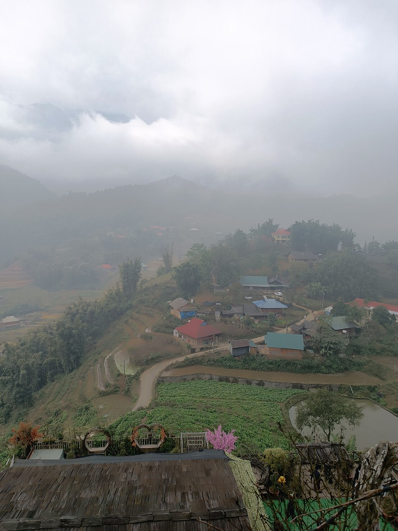
Source: Mickey Dai Phat via Wikimedia Commons, CC BY-SA 4.0.

Lunch usually happens around this part of the day, often in a family home in Lao Chai or in a village along the way. This is also a good point to refill water and change socks if your shoes got wet on the descent.
A note on village etiquette applies all along this route. Walk through quietly, ask before photographing people at close range, and keep to the paths rather than cutting across planted terraces. The villages on this route are working homes and farms, not a theme park.
Step 3: Lao Chai down to Ta Van
The final section runs from Lao Chai along the valley floor to Ta Van, and it takes about 2 hours. The walking is mostly flat, and the valley widens as you go. You follow the river downstream, past more terraces and scattered houses, to Ta Van.
Ta Van is a Giay village, and it feels different from the Black Hmong villages earlier on the route. The houses, the layout of the village, and the rhythm of daily life change subtly as you cross from one community to another, and that change is one of the quiet pleasures of walking the whole route instead of visiting a single village by road.
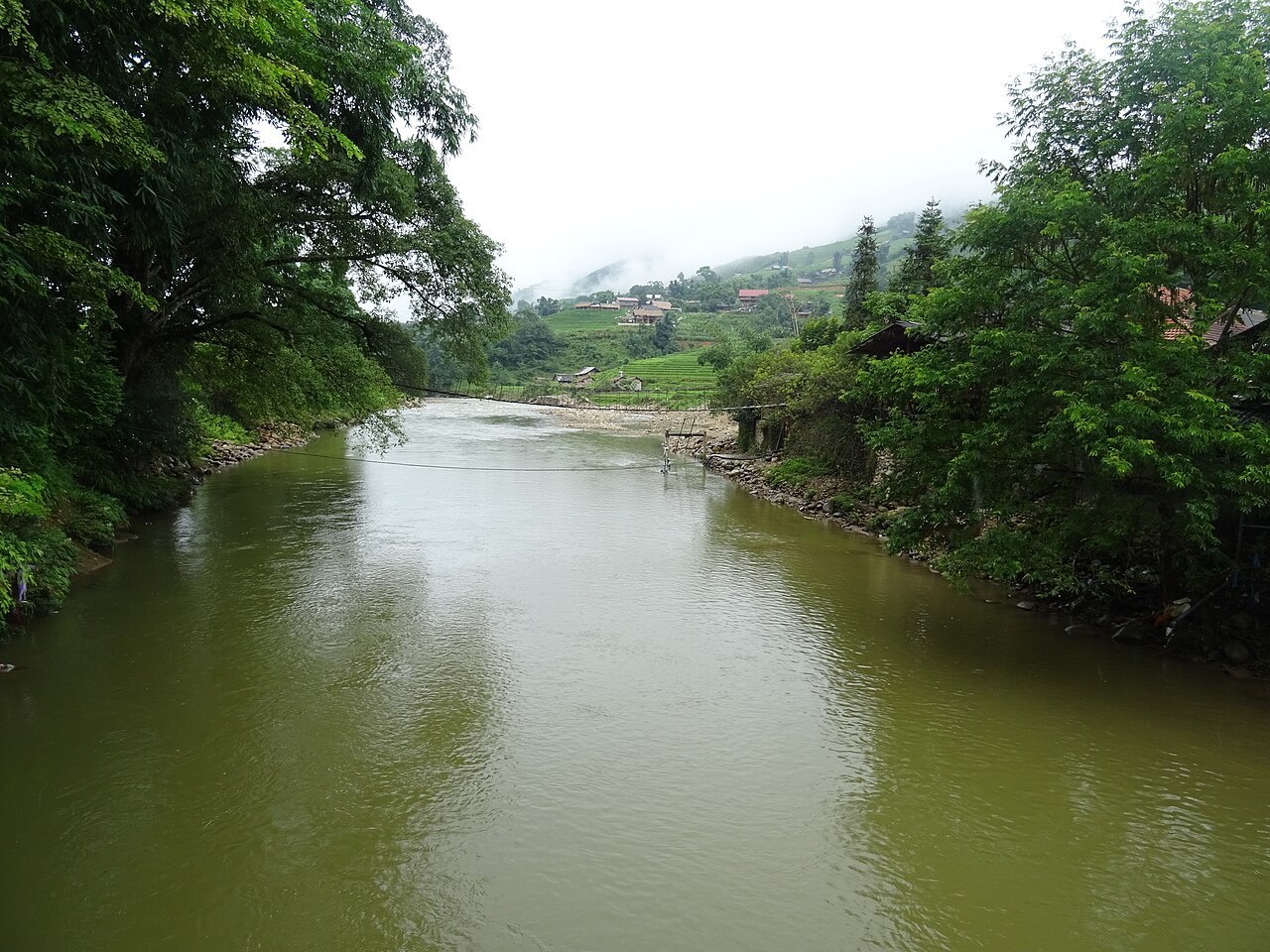
Source: Christophe95 via Wikimedia Commons, CC BY-SA 4.0.

Most walkers arrive in Ta Van in the mid to late afternoon. If you are staying the night, you settle into a homestay and eat dinner with your hosts. If you are returning to Sapa town the same day, your guide or driver will arrange the road transfer from Ta Van.
How hard is it, honestly?
This route is moderate, not hard, for a reasonably fit walker. The distance, about 12 km, is the easy part. The challenge is the downhill start, the uneven steps, and the full day on your feet. If you walk regularly at home, you will manage it comfortably. If you rarely walk, the day will feel long, but still doable at a slow pace with breaks.
Heat and rain change the difficulty more than distance does. In summer, rain makes the paths slick, and in winter, mornings in Sapa town are cold. In every season, start early, walk slowly on the descent, carry water, and keep a rain layer in your daypack.
Planning the day
Start early, and eat breakfast in Sapa town before you set out. Morning mist often clears by mid morning, and an early start leaves a comfortable margin for the afternoon.
Arrange your guide and your night in Ta Van in advance if you plan to stay, rather than sorting it out on the trail. Confirm where you will meet your guide in Sapa town, what lunch arrangements are included, and how you will get back to town if you are not staying overnight. If the weather turns, listen to your guide: light rain does not cancel this walk, but heavy rain turns the descent slippery, and a shortened route is a better day than a miserable one.
Your next step
Read our Sapa trekking pillar page for the full picture of Sapa routes and seasons, and see the classic 1-day Y Linh Ho, Lao Chai, Ta Van trek for the tour that follows this route. If you would rather talk it through first, message Cloud Valley on WhatsApp for a per-group quote and advice on the best day for your dates.
Walk it with us
Every route in these guides ends at Cloud Valley. Sleep where the trail ends, not back in town.
Sapa Trekking Guide · 1 Day Valley Trek · 2 Day Homestay Trek
More guides

Squat Toilets and Shared Bathrooms: What Homestays Are Really Like
The toilet is the part of a Sapa homestay nobody photographs. Here is what the bathroom is actually like, and the three small things to pack so it never ruins your night.

Booking a Trek Online vs in Town: What Changes
You can book your Sapa trek from home weeks ahead, or walk into an office in Sapa town the day before. Both work. Here is what actually changes with each choice.

Your Luggage While You Trek: Storage Options That Actually Work
You cannot drag a rolling suitcase down muddy terrace steps. Here is where your big bag actually goes while you walk, and what to carry instead.