Muong Hoa Valley: Terraces, River and Ancient Stones
Muong Hoa Valley is the valley most Sapa photographs come from: terraces stacked down both slopes, a stream running along the valley floor, villages in between, and a field of carved stones whose meanings are still not settled. Walk it slowly, and the valley makes sense as a working place, not just a view.
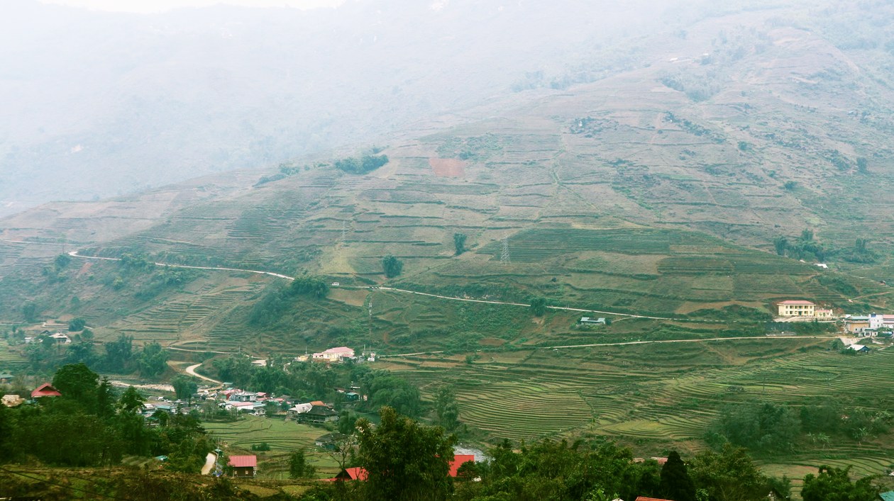
Muong Hoa Valley: Terraces, River and Ancient Stones
Cover photo: Thao Ha via Pexels, terraced fields in Sapa, Lao Cai.
Muong Hoa Valley is the valley behind most of the Sapa photographs you have already seen. Terraces climb both slopes, a stream threads along the valley floor, villages sit among the fields, and a field of stones in the lower valley carries carvings nobody has fully decoded. Drive past on the road above and you get the postcard. Walk down into it, and you get a working valley where terraces, water, and villages all depend on each other.
Where the valley sits, and how to read it
Muong Hoa Valley runs southeast of Sapa town, about 8 to 10 km from the town centre to the upper valley. The valley floor follows the Muong Hoa stream for roughly 15 km, past Y Linh Ho, Lao Chai, Ta Van, Hau Thao, and on toward Ban Ho. Black Hmong, Giay, Red Dao, and Tay families live and farm here, and the villages along the stream are why the valley is worth walking rather than just photographing.
Read the valley from the bottom up, not from the road above. From a viewpoint, the terraces look like decoration. From the valley floor, you see what they are: level steps cut into steep slopes so water can be held on land that would otherwise wash away. Each step has an earth wall, a flat planting surface, and a channel that lets water move down to the next step. Farmers built them by hand over generations, and they still maintain them by hand.
The terraces through the year
The valley changes its character with the rice calendar. In April and May, many terraces are flooded for planting, and on a calm morning they act as mirrors, reflecting sky, cloud, and hillside. In June through August, the young rice fills in, and the valley turns a deep, even green. From late August into September, the rice ripens and the valley turns gold, the season most photographers come for. In winter, the fields are bare or resting, mist sits low, and the shape of the terraces shows more clearly than in any other season.
Each season asks for a different plan: an early start in flooded season, a slow walk in green season, patience at viewpoints in golden season, and warm layers in winter.
The river that holds the valley together
The Muong Hoa stream is easy to overlook, because the terraces steal the eye, but it is the reason the valley works. It feeds the terraces, waters the villages, and gives the walking route its line. The classic valley walk follows it downstream, from Y Linh Ho through Lao Chai to Ta Van, crossing it on simple bridges and walking beside it on paths that farmers use every day.
Walking beside the stream changes the scale of the place. From above, the valley looks vast and empty. At stream level, you hear water, you pass buffalo on a path, and you see how close the houses, the fields, and the water really are. If you lose the path, follow the water downstream toward the next village, and ask a local walker for the next bridge crossing rather than guessing at a fork.
After rain, the stream rises and the paths beside it get muddy and slippery, so wear shoes with grip and give yourself extra time. Treat every narrow bridge with care and keep your hands free.
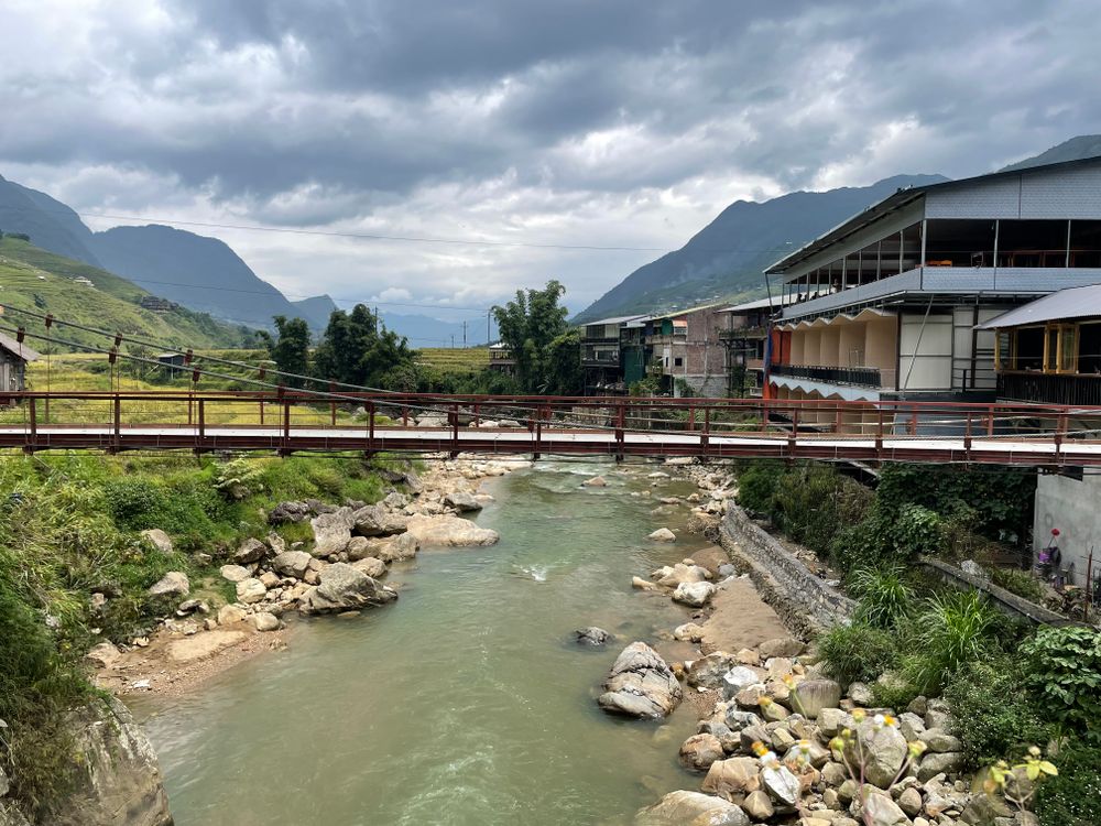
Source: Andrei Diachenko via Pexels, a bridge over a river in Sapa, Lao Cai.
The ancient stones, and what not to assume
In the lower valley, around the Hau Thao and Ta Van area, lies the Sapa ancient stone field, a scattering of more than 150 boulders across roughly 8 square kilometres, many carved with patterns: circles, parallel lines, rectangles, human figures, and shapes that look like houses, fields, and roads. The field was brought to wider attention in 1925 by the French archaeologist Victor Goloubew, and it is a protected site.
The honest point is that the carvings are still not fully decoded. Researchers agree that they are old and important, and they disagree about exactly what many of them mean. Some patterns may mark farming or ritual, and some may simply be marks whose purpose has been lost. That uncertainty is part of the place, and any guide who gives you a confident story for every stone is guessing.
Walk the stone field the way you would walk any protected site. Stay on paths, look closely without climbing on carved stones, and do not touch or trace the carvings. A local guide can show you which stones carry the clearest carvings and which ones are best seen from the path.
The villages in between
The villages are not stops on a viewing route. They are homes, and the walk works best when you treat them that way. Y Linh Ho is small and quiet, a good first taste of valley life after the descent from town. Lao Chai is larger, home to Black Hmong families, with houses, fields, and workshops along the path. Ta Van, home to Giay families among others, is where the classic one day walk ends and many two day walks spend the night. Further along, Hau Thao offers quieter paths beyond the classic route.
Buy something small from a village shop, eat lunch in a village house when that is offered, and ask before photographing people, especially children. A short, polite question, or one through your guide, is usually enough, and a refusal is easy to accept with a smile.
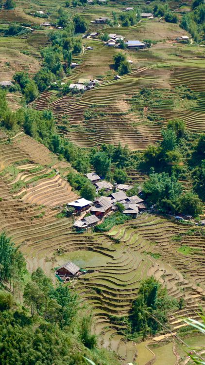
Source: Duong Nguyen via Pexels, rice terraces and a village in Sapa, Lao Cai.
How to walk it well
For a first visit, walk the classic line: Sapa town down to Y Linh Ho, on through Lao Chai, and finishing in Ta Van. It is the valley in miniature, with terraces, stream crossings, villages, and an easy finish. For a longer trip, stay overnight in Ta Van and continue the next day, or add Hau Thao for a quieter second day. See Y Linh Ho, Lao Chai, Ta Van: The Classic Route Explained Step by Step for the step by step route, and Ta Van Village Guide: Where the Classic Sapa Trek Ends for the end of the walk.
Start early, carry water, a rain layer, and shoes with grip, and give the walk a full day. Do not plan it around a single photograph: the best views often come after a bend in the path.
Your next step
Read our Sapa trekking pillar page, and see the classic 1-day Y Linh Ho, Lao Chai, Ta Van trek if you want to walk the valley in a day, or the 2-day Ta Van homestay trek if you want to sleep in the valley and walk on the next morning. Message Cloud Valley on WhatsApp or Zalo for a per-group quote and advice on which valley walk fits your group.
Walk it with us
Every route in these guides ends at Cloud Valley. Sleep where the trail ends, not back in town.
Sapa Trekking Guide · 1 Day Valley Trek · 2 Day Homestay Trek
More guides

Squat Toilets and Shared Bathrooms: What Homestays Are Really Like
The toilet is the part of a Sapa homestay nobody photographs. Here is what the bathroom is actually like, and the three small things to pack so it never ruins your night.

Booking a Trek Online vs in Town: What Changes
You can book your Sapa trek from home weeks ahead, or walk into an office in Sapa town the day before. Both work. Here is what actually changes with each choice.

Your Luggage While You Trek: Storage Options That Actually Work
You cannot drag a rolling suitcase down muddy terrace steps. Here is where your big bag actually goes while you walk, and what to carry instead.